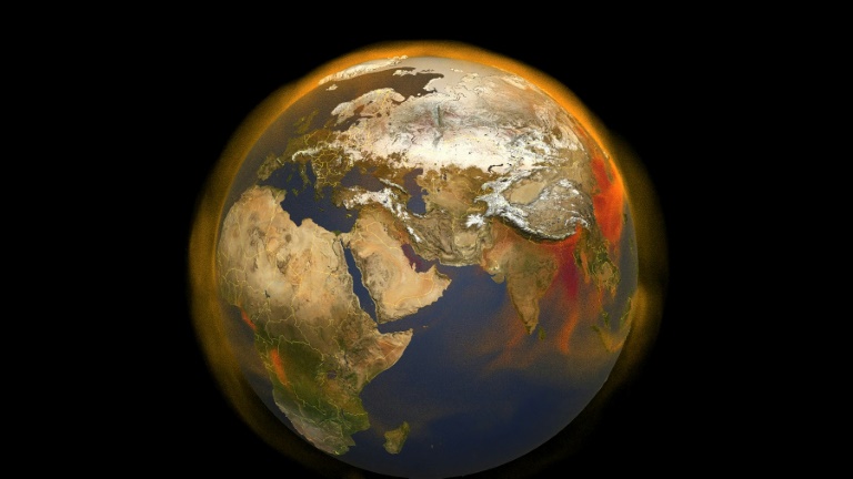
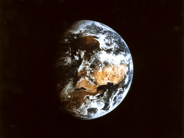
A yellow streak representing high concentrations of methane, a dangerous greenhouse gas, is visible over southern Iraq on a map produced by Kayrros, a French firm that uses satellites to track leaks from fossil fuel facilities.
The source of the immense leak discovered in 2019 was never officially confirmed — and it is only one of many.
The satellite map shows blotches of colour splattering the globe from the United States to Russia, and Algeria to Turkmenistan, bearing witness to poor maintenance in the oil and gas industry.
Methane (CH4) ranks number two in greenhouse gasses emitted after carbon dioxide (CO2). But while it receives less attention, it is extremely dangerous for the environment. By weight, it creates 28 times as much warming as CO2 over a century.
“We see huge leaks, intentional or unintentional releases that are linked to the production and transport of natural gas and petrol just about everywhere in the world,” said Kayrros’s Jean Bastin.
“Today we can track them and link them with events that can be avoided easily,” he added.
Kayrros uses free data from Europe’s Sentinel satellites to find and track the methane leaks.
The fossil fuel industry is an important source of methane emissions.
The International Energy Agency estimates that it emitted 120 million tonnes of methane last year, about a third of the amount linked to human activity. Moreover, much of that leaked methane can be easily prevented at little or no cost, it believes.
The IEA said in a recent report that it “estimates that more than 70 percent of current emissions from oil and gas operations are technically feasible to prevent and around 45 percent could typically be avoided at no net cost because the value of the captured gas is higher than the cost of the abatement measure.”
– ‘We see them’ –
The European Union and the United States are drafting an agreement to reduce methane emissions by at least 30 percent by 2030.
“That’s completely feasible,” Kayrros President Antoine Rostand said, pointing to the all too frequent practice of emptying gas left in pipelines into the atmosphere ahead of maintenance work.
Old and poorly maintained pipelines are the biggest culprit of leaks.
“Now that we see them, there’s rising awareness,” he said.
Kayrros works for the IEA as well as oil and gas producers who are seeking to improve their environmental practices.
It also counts among is clients investment funds who are seeking to evaluate the climate risks of the companies in which they invest, Rostand said.
The use of satellites is “one of the most recent and promising advances in understanding the level of methane emissions worldwide,” the IEA said last year.
Previously companies had to set up networks of heat-sensitive cameras to catch methane leaks, which usually meant they had at best a partial view of the situation.
“A key advantage of satellites is that they can help locate large emitting sources promptly,” it added.
– Race to spot smaller leaks –
McGill University Professor Mary Kang agreed that satellites can help reduce large leaks from the oil and gas industry infrastructure.
“However, I would say that it misses smaller leaks that can amount to a lot as well because there are many of them,” she said.
Kayrros and its competitors are working to improve the sensitivity of their technology to detect smaller leaks.
The Canadian firm GHGSat is in the process of deploying a constellation of its own satellites that it says will be able to detect emissions 100 times smaller than some current satellites.
It already has three satellites in orbit and is deploying more.
The company is working with TotalEnergies to monitor the French firm’s offshore oil and gas facilities, which have until now escaped monitoring as the sun reflecting off the sea disrupted readings.
The US pressure group Environmental Defense Fund plans to launch its own satellite, called MethaneSAT, in order to get even more detailed readings to find small leaks.
The satellite is scheduled to be placed into orbit by SpaceX in the autumn of 2022.

