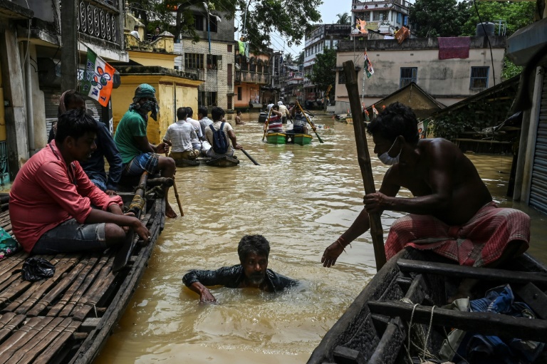
The number of people exposed to floods worldwide has surged almost a quarter over the last two decades, according to satellite-based data that shows an additional 86 million now live within flood-prone regions.
Flooding is by far the most common of extreme weather events made more frequent and potent by rainfall patterns supercharged by climate change.
Deadly inundations, such as recently in India, China, Germany and Belgium, inflict billions worth of damage, often disproportionally affecting poorer sectors of society.
Most flood maps rely on modelling based on ground-level observations such as rainfall and elevation, but they can often entirely miss regions that are historically not flood-prone.
To fill in those gaps, a team of US-based researchers examined satellite data from twice-daily imaging of more than 900 individual flood events in 169 countries since 2000.
They used the data to create the Global Flood Database, which provides open source information on the death toll, displacement and rainfall levels linked to each of the 913 floods.
Writing in the journal Nature, the researchers found that up to 86 million people, driven by economic necessity, moved into known flood regions between 2000-2015 — a 24-percent increase.
A total of 2.23 million square kilometres (860,000 square miles) — more than the entire area of Greenland — were flooded between 2000 and 2018, affecting up to 290 million people.
And it’s only going to get worse.
Computer modelling produced estimates that climate change and shifting demographics would mean an additional 25 countries facing a high risk of flooding by 2030.
Lead study author Beth Tellman, a researcher at Columbia University’s Earth Institute and co-founder of the flood analytics firm Cloud to Street, told AFP the number of additional people now at risk of flooding was 10 times higher than previous estimates.
“We are able to map floods that are often unmapped or not typically represented in flood models, such as ice melt floods or dam breaks,” said Tellman.
“Dam breaks are especially impactful. In these dam overflow or dam break events, up to 13 million people were impacted, across just these 13 events.”
The majority of flood-prone countries were in South and Southeast Asia, but the satellite data showed previously unidentified increases in exposure across Latin America and the Middle East.
– ‘Retreat only option’ –
A leaked UN climate science report, seen exclusively by AFP, predicts flooding will in future displace 2.7 million people in Africa annually and could contribute to 85 million forced from their homes by 2050.
Just 1.5 degrees Centigrade of warming — the most ambitious Paris Agreement temperature goal — would see two or three times more people affected by floods in Colombia, Brazil and Argentina, four times more in Ecuador and Uruguay, and a five-fold jump in Peru, the IPCC report said.
Most flood events in the database unveiled on Wednesday were caused by excess rainfall, followed by storm surges, snow or ice melt, and dam breaks.
Tellman said the research showed the benefit of building in flood prevention measures to rural and urban planning.
“It is well known that spending $1 on disaster management and prevention can save up to $6 on relief and recovery efforts,” she said.
In a linked comment, Brenden Jongman, an expert at the World Bank, said the flood database was a “crucial step” in understanding the link between climate change and socio-economic development.
“Satellite technology can track changes in protective ecosystems, similarly to its use in monitoring flooding and population changes,” he said.
“However, even the best combination of infrastructure and nature-based approaches might be insufficient to deal with rising sea levels — the only option for some communities will be to manage their retreat out of flood-prone areas,” added Jongman.


